CalTopo v1.24.5 (Premium) – Android Application for Mapping and Adventure
Advanced Tool for Off-Trail Trip Planning and Offline Use
Premium Version with Professional Features for Mountaineers, Guides, and Rescue Teams
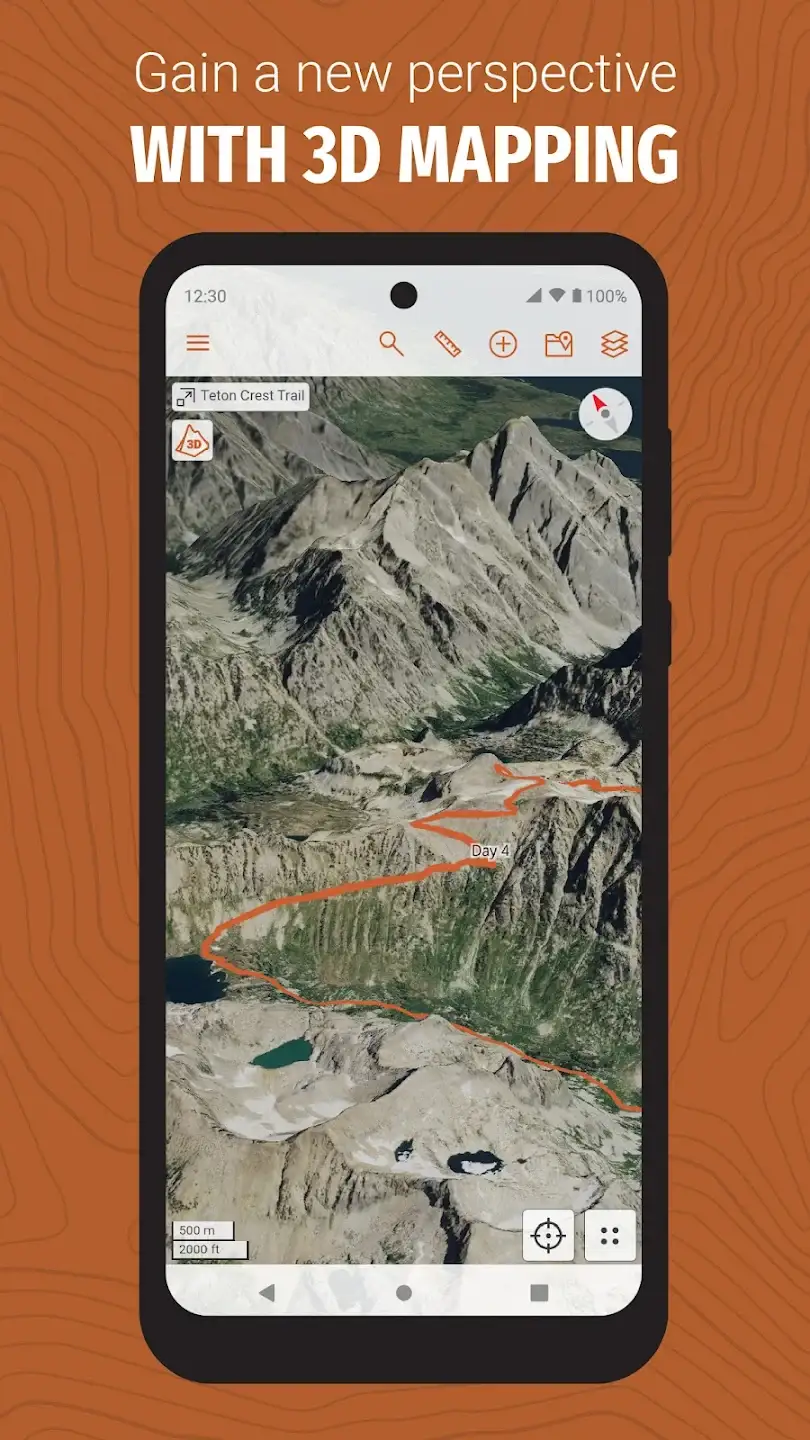
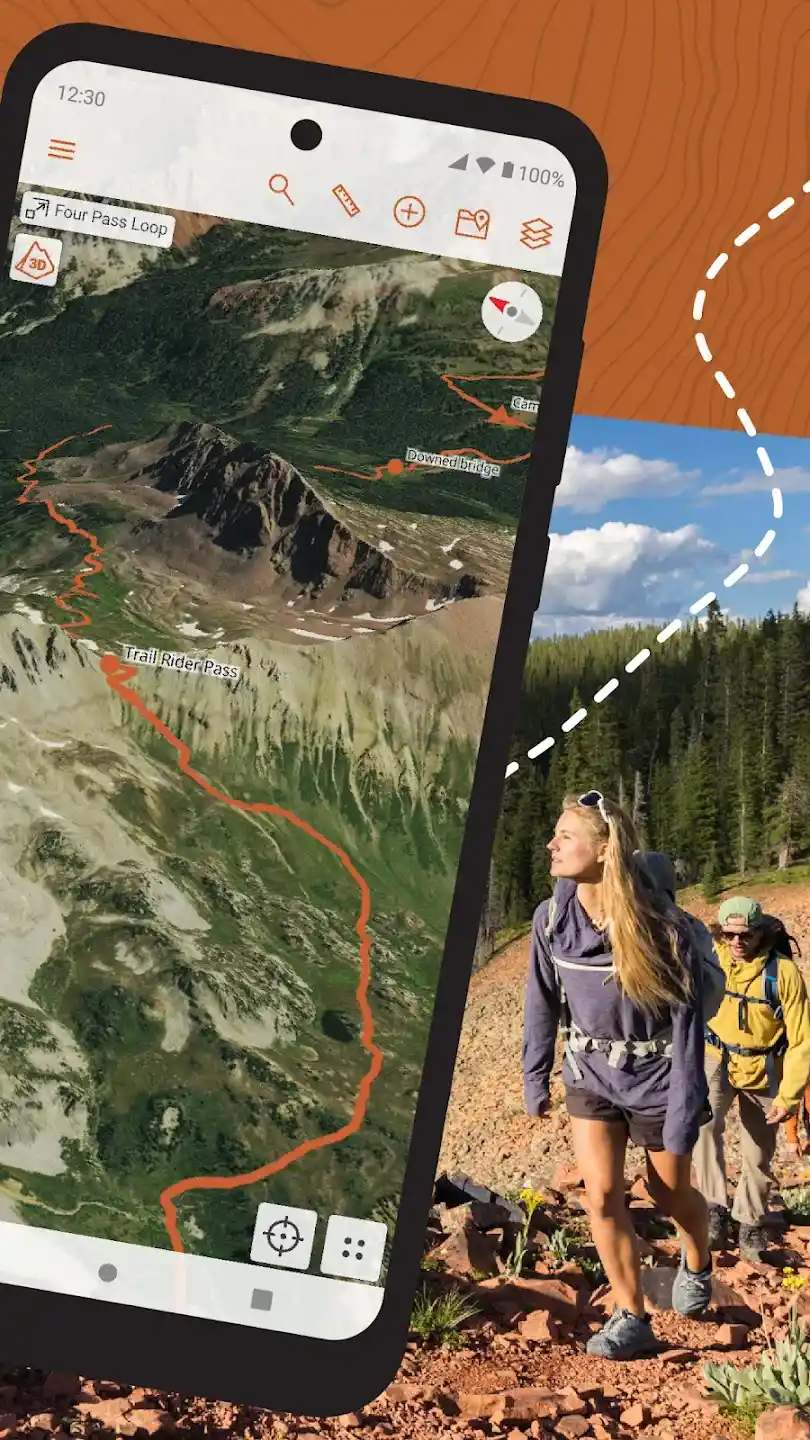
When it comes to off-trail trips, mountaineering, or outdoor adventures, having a precise tool for mapping and navigation becomes crucial. Many users look for an app that not only provides standard maps but also offers live data and advanced features for specific conditions such as snow, wind, or terrain status. CalTopo is designed exactly for this need; a powerful app that combines multi-layer maps, real-time data, and offline usability to deliver a unique experience in planning and navigation in nature. This app allows users to carry CalTopo’s professional tools with them at all times. Whether you are in the mountains, forest, or desert, you can load maps, review routes, and even use offline features without internet. This version is designed for professional mountaineers, mountain guides, avalanche instructors, and rescue teams, enabling them to make more accurate and safer decisions.
Features and Capabilities of CalTopo:
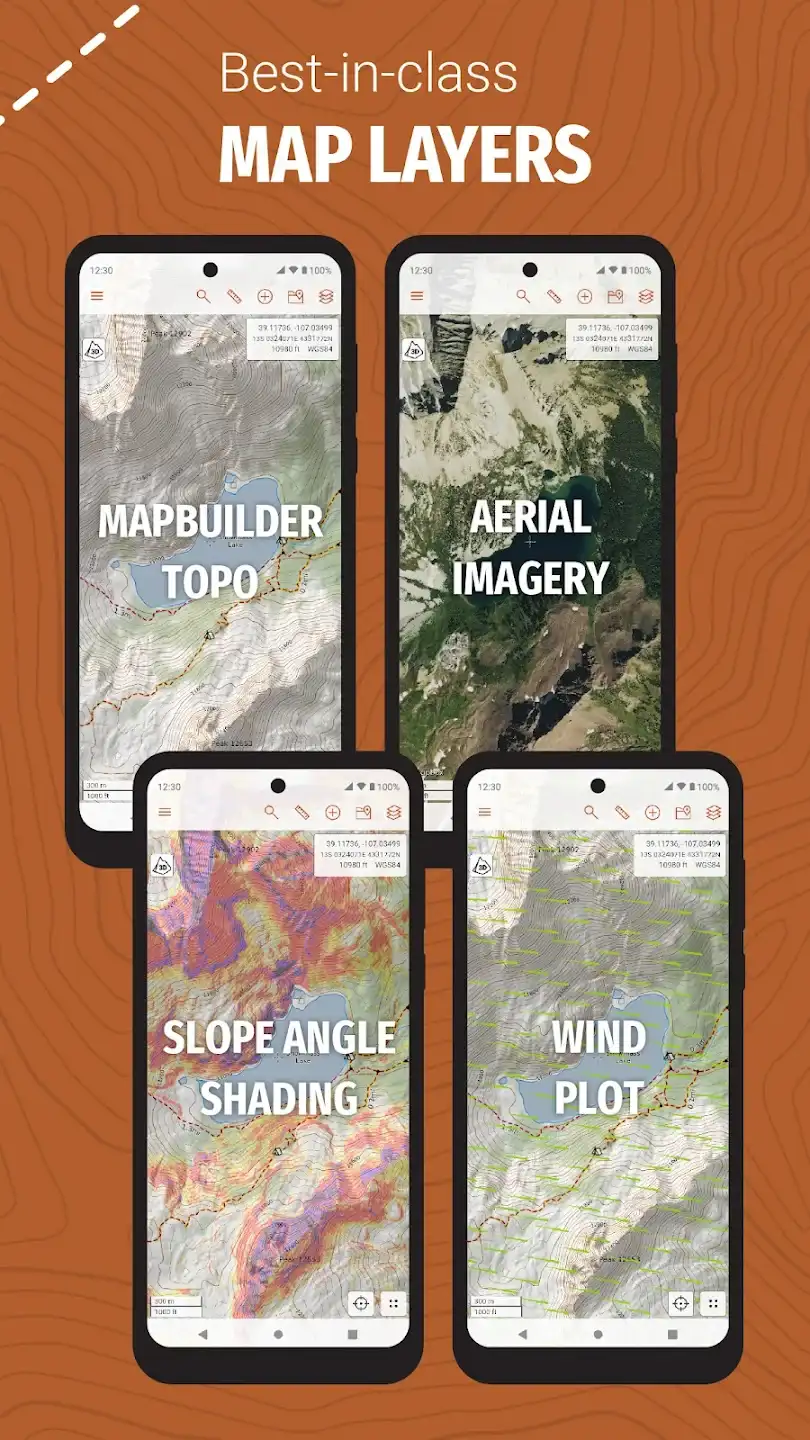
- Multi-layer Maps: Access to USGS maps, MapBuilder, and specialized layers such as land management, solar radiation, fire activity, and slope shading.
- Satellite Imagery: Receive daily and weekly high-quality images to monitor current conditions and environmental changes.
- Snow and Water Data: Accurate information from SNOTEL stations for snow depth and over 7,500 rivers and reservoirs for water status.
- Weather Forecasts: Specialized altitude-based data for wind, temperature, and weather conditions.
- Team Tools: Ability to create shared maps, simultaneous editing, and real-time location sharing.
- Offline Mode: Use maps and data without internet, ideal for trips beyond network coverage.
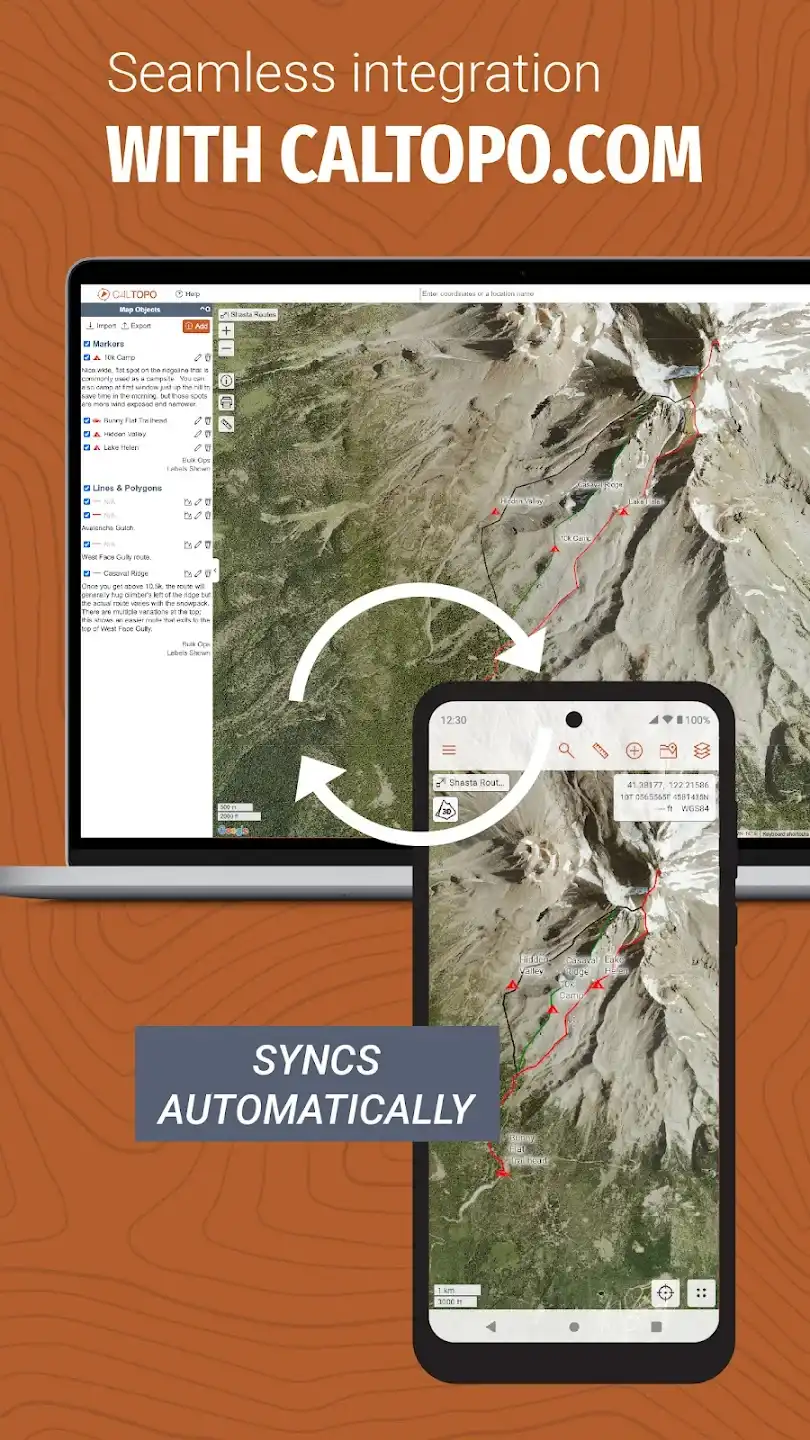
- Fast Synchronization: Direct connection with the CalTopo web version and automatic syncing of changes across devices.
The CalTopo user interface is simple yet powerful. Users can easily enable or disable different map layers, design new routes, and view live data. The 3D map display feature also provides a more realistic experience of the terrain and paths. These features have made CalTopo one of the most popular mapping apps among adventurers and professional teams. Compared to similar apps, CalTopo focuses more on specialized data and real conditions. Many apps only offer general maps, but CalTopo combines snow, water, wind data, and satellite imagery to provide a more comprehensive view of the environment. This feature makes the app a rare and valuable choice for off-trail trips and special conditions. CalTopo – the Android app is not just a mapping tool; it is a smart companion for adventurous journeys. By combining multi-layer maps, live data, and offline usability, it allows users to design more precise routes, anticipate potential hazards, and travel with greater confidence. The premium and full version of this app is available for direct download through the DroidCove website, enabling users to access all professional features. With CalTopo, every trip becomes a safe, modern, and exceptional experience.